Skip to main content
NAVIGATION
Contact
Help
Advanced Search
Search Term
SEARCH
Account Menu
HOME
COLLECTIONS
INSTITUTIONAL REPOSITORY
ARCHIVAL COLLECTIONS
THESES AND DISSERTATIONS
CONTRIBUTE
JOURNALS
ABOUT
CONTACT
FIND WHAT YOU ARE LOOKING FOR
Search Term
SEARCH
2149
Results for:
All
Collections
Objects
Results Per Page
10
20
50
RELEVANCY
DATE
TITLE
African Americans--Politics and government
(x)
Search results
For:
Subjects = African Americans--Politics and government
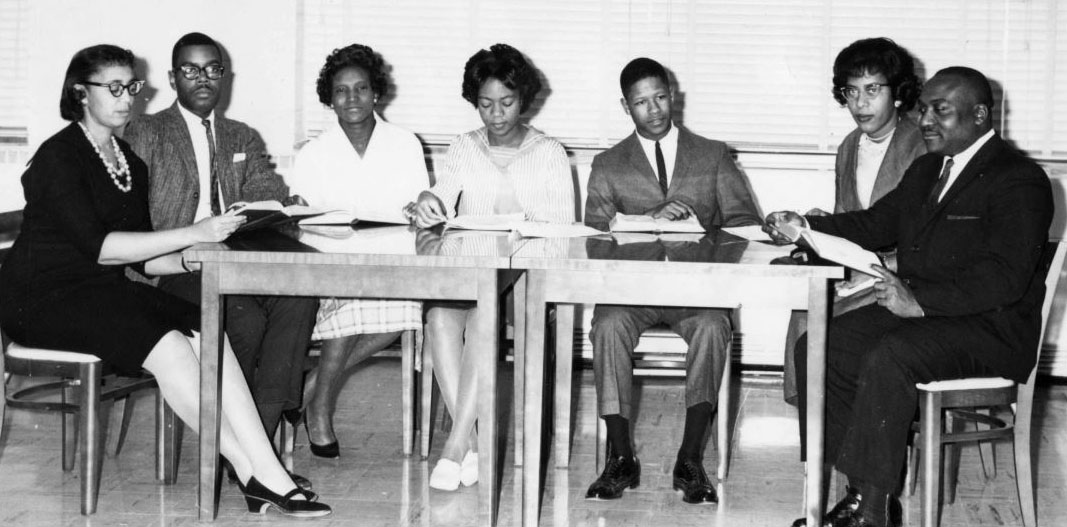
Grace Towns Hamilton Papers
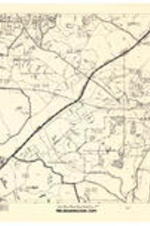
Atlanta Area Metropolitan Map Series Pre-Enumeration Copy, Item 18, October 1970
Date Created
1970-10-29
Description
Map of Congressional Districts 5 and 7, Mableton, Cambellton, and Atlanta Divisions.
Subject
African Americans--Politics and government, African American women
Collection
Grace Towns Hamilton Papers
Grace Towns Hamilton Papers
Atlanta Region Metropolitan Planning Commission, 1970
Date Created
1970-01
Description
Map of Atlanta delineating counties from the Atlanta Region Metropolitan Planning Commission.
Subject
African Americans--Politics and government, African American women
Collection
Grace Towns Hamilton Papers
Grace Towns Hamilton Papers
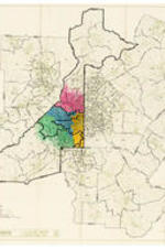
Atlanta Region 1970 Census Tracts, 1973
Date Created
1973-01-01
Description
Detailed base map of the Atlanta regions census tracts with central Fulton County color coded.
Subject
African Americans--Politics and government, African American women
Collection
Grace Towns Hamilton Papers
Total Population Figures for the State of Georgia, 1970
Date Created
1970-01
Description
Population figures for the state of Georgia as taken from the United States Census of 1970.
Subject
African Americans--Politics and government, African American women
State of Georgia County Outline Map, Plan III, circa 1970
Date Created
1968/1972
Description
County outline map of Georgia from the Secretary of State.
Subject
African Americans--Politics and government, African American women
Plan 1, circa 1970
Date Created
1968/1972
Description
Map of Atlanta and Southwest Atlanta, handwritten on recto: "Plan 1".
Subject
African Americans--Politics and government, African American women
State of Georgia County Outline Map, Plan III Verso, circa 1970
Date Created
1968/1972
Description
Verso of county outline map of Georgia from the Secretary of State.
Subject
African Americans--Politics and government, African American women
Georgia County Subdivisions - Census County Divisions and Places, circa 1970
Date Created
1968/1972
Description
Map of Georgia with county subdivisions.
Subject
African Americans--Politics and government, African American women
Plan "A" Congressional, circa 1970
Date Created
1968/1972
Description
Map of "Plan A" Congressional on #18.
Subject
African Americans--Politics and government, African American women
Fulton County Congressional District Divisions, circa 1970
Date Created
1968/1972
Description
Map of Atlanta with 4th, 5th, and 6th boundary markings.
Subject
African Americans--Politics and government, African American women
Fulton County Congressional District Divisions, circa 1970
Date Created
1968/1972
Description
Map of Atlanta with 4th, 5th, and 6th boundary markings and "House Bill" written on recto.
Subject
African Americans--Politics and government, African American women
Georgia Enumeration Districts, Part 7, 1970
Date Created
1970-01
Description
Map of Georgia enumeration districts from the Cartographic Services Laboratory from the University of Georgia.
Subject
African Americans--Politics and government, African American women
Mason/Pinkston Congressional Plan #18, circa 1970
Date Created
1968/1972
Description
Map of the counties of Georgia with annotations. Written on recto: Mason/Pinkston Congressional Plan #18-A.
Subject
African Americans--Politics and government, African American women
Georgia Official Highway Map, 1968
Date Created
1968-01
Description
Official highway map of Georgia, detailing cities.
Subject
African Americans--Politics and government, African American women
Congressional Districts of Georgia, 1970
Date Created
1970-01
Description
Map of Congressional districts of Georgia.
Subject
African Americans--Politics and government, African American women
Plan "A" Congressional, circa 1970
Date Created
1968/1972
Description
Map of "Plan A" Congressional on #18.
Subject
African Americans--Politics and government, African American women
Fulton County Congressional District Divisions, circa 1970
Date Created
1968/1972
Description
Map of Atlanta with 4th, 5th, and 6th boundary markings.
Subject
African Americans--Politics and government, African American women
Alternate A - 5th District Fulton County, circa 1970
Date Created
1968/1972
Description
Map of Atlanta with 4th and 5th boundary markings and "Alternate A" written on recto.
Subject
African Americans--Politics and government, African American women
Map of Atlanta, 1969
Date Created
1969-09
Description
Map of Atlanta with districts outlined and color coded.
Subject
African Americans--Politics and government, African American women
Georgia Official Highway Map, 1968
Date Created
1968-01
Description
Official highway map of Georgia.
Subject
African Americans--Politics and government, African American women
❮❮
❮
1
2
3
4
5
…
❯
❯❯